

Cowley's Voyage Round the World
William Ambrosia Cowley
Galápagos section of Sloane Ms. 1050. Minor punctuation and spelling changes made for clarity. Bracketed numbers indicate Ms. pagination.
Cowley's summary of island names on page 16 written as continuous text, but displayed here as numbered list for readability.
Phrase {in braces} is omitted in Pepys Ms. 2826.
Text on darker background describes interval between Cowley's first and second visits to the islands.
Modern latitudes and longitudes from Greenwich are inserted [in brackets], based on Cowley's positions written in the ms., which he states (ms. p. 21) are given “… reckoning from the Pick of Tennereefe (modern 16° 15' W.), where most longitude is reckoned from.” Thus, for example, Cowley's 278° 50' is in modern notation, 97° 25' W. Cowley's longitudes are consistantly off by 2 to 9 degrees.
Herman Moll's map in Morgan Ms. 3310, with tracks of Batchelors Delight and Nicholas added.
June 1684 [13]
About the beginning of this month, we saw an island on our starboard [sic, port] side, making high land and low land, being a very likely island to have water upon, being well replenished with wood, but by reason of the strong current that runneth there, we could not fetch it. That island I named King Charles the Second's Island, by my judgement it lyeth in the latitude of One South latitude and 30 minutes, longitude 278 degrees and 50 minutes [97° 25' W.].
Standing still to the westward, I saw several islands, but that which I liked best I came to anchor under in a good bay, having 7 fathoms water, there being upon this island to the South end a good harbour for many ships to ride.
[14]
I believe his Majesty's Navy might ride there in safety. We sent the boat ashore, but found no water there. But we found land turtle very great, and sea turtle very good and large and great plenty, and a sort of fowl called flamingoes, with guanos [iguanas] which our men brought aboard. The small birds being not in the least possessed with fear, they lighted on our mens' heads and arms, and they took them off which at first seemed strange to me. But I did the same my self after that.
This island I named the Duke of York's Island, but now by the grace of God King James the Second's Island. The island lyeth from the latitude of One degree South to the Lyne Equinoctial.
The island on the East side of the island, stretches away W. N. W. And at the westmost end is a goodly sandy bay about the point, where there lyeth a fine high island very green [Albany Island], which maketh a good harbour, where there is water, and good turtle, sea and land turtle, and good fowls in abundance. From that point the land stretcheth away South West and by South, and further of King Jame's Island {hath not been discovered by reason that there ran so strong a current between the King's Island} and The Duke of Albemarle's Island, they stretching away all one course, differing not much in latitude or longitude—not more than twenty minutes. The Duke's Island [Albemarle] stretching more to the northward, and further to the southward than that part of the island that I fell withall. But I cannot say how far His Majesty's Island stretcheth away to the southeast, by reason that most of those islands having had sulphurous matter that hath sett them on fire, they have been burned formerly, and some parts of them blown up. The land and rocks on some of them are lying in so much confusion that there is no travelling on them. The land that hath been burned seemed like to cinders, but very heavy, which made me think they were mixed with some metal, for the mother of metals is here in great plenty upon this island, which they say is brimstone.
June 1684 [15]
We were sailing along the Duke of Albemarle's Island, the sun shining made us think one hill had been covered with gold, [but] when we came to see it, it was fine brimstone, as fine as flour. The Duke of Norfolk's Island lying to the eastward of the King's Island, lying from the latitude of 35 minutes South to the latitude of 5 minutes North, and longitude 277 degrees, 42 minutes [98° 33' W.]. I sent a ship to discover it, which sailed almost round it. On the north side there is a good road. The island, being about 40 miles in length, lying to the eastward of King James' Island 10 leagues.
King James the Second's Island lieth the northernmost end under the line, and the southernmost end about one degree. The island maketh like the point of a fort. The land stretcheth from the eastermost point W. N. W. 12 leagues. The other part of the land stretcheth away to the southward. The northernmost part of it lyeth in the longitude of 277 degrees, 12 minutes [99° 3' W.], and latitude 0. There being upon this island land turtle almost 200 pounds weight apiece. I sat upon the back of one of them when they came aboard to try his strength. He would have carried me had I been much heavier. The flesh of them to many of our judgements exceeded the sea turtle, although the sea turtle there is a good as ever I eat in any part of the world where they been accounted most rare.
From King James's Island we sailed to another island lying to the westward of the King's island, stretching away to the northward, N. W. and by W. to the latitude of 15 minutes North. The land being very high up in the country. By the water side making as you come in with from the eastward, like to a long ridge or plain hill, the east most side of it being an iron shore, where there is no coming to an anchor.
[16]
It looketh into the southward of King James's Island. I sailed to the north end thereof, where by chance I let go an anchor in good ground. We being then 5 ships in company; 3 of them almost loaden with provisions as flour, sweet meats & sugar. We seeking a place to put these provisions on shore against a time of scarcity, this end being the worst part of the island. Yet it affordeth provisions in abundance, as fish, turtle, alguanas & fowls in abundance. This island I gave the name of the Duke of Albemarle's Island. The belonging to it a stately harbour, lying on the west side thereof. We sailed along the west side of the island towards the southward. This island lyeth from the latitude of 1 degree 30 minutes South to the latitude of 15 minutes North by my judgement, for we could not get to the south end thereof for the strong current, but having seen it at a distance.
There being in number 15 islands that I have seen, I have named 8 of them as
- King Charles the Second's Island lying in the latitude of 1 degree, 30 minutes and longitude 278 degrees 50 minutes [97° 25' W.],
- The body of King James's Island lying in the latitude of 30 minutes south and longitude 277 degrees 12 minutes [98° 3' W.],
- The Duke of Norfolk's Island lying in the latitude of 20 minutes south and longitude 277 degrees 42 minutes [98° 33' W.],
- The Duke of Albemarle's Island lying in the latitude of 52 minutes south and longitude 277 degrees 16 minutes [98° 59' W.],
- The Lord Norris's Island lying in the latitude of 40 minutes north and longitude 277 degrees 52 minutes [98° 23' W.],
- Lord Wainman's Island lying in the latitude of 2 degrees 15 minutes [north], longitude 277 degrees 33 minutes [98° 42' W.].
- There being 2 islands more, as Lord Culpepper's Island and
- Cowlys Island.
June 1684 [17]
We sailed to the northwest of the Duke of Albemarle's Island, where we put on shore fifteen hundred bags of flour. We carrying our Captain on shore, he having been 3 weeks sick. We sought for water, but could find none. We were forced to go to the main to water, thinking to touch at the Coconut Island if we could find it, it lying in the latitude of 5 degrees 0 minutes & longitude 279 degrees 1 minute [97° 14' W.], it being layed down false in their drafts, it bearing from the Galipoles N. N. E., & being by the Spaniards layed down 272 degrees of longitude, 16 minutes [103° 59' W.]. It being layed down so false we could not find it, it being layed down 6 degrees 45 [minutes] of longitude further to the westward than it lyeth.
I being in the Lat. of 5: Deg N. & judging I had the island to the westward of me, the same day the wind came up westwardly, which bloweth from that latitude to the Northward, this being the month of July. From that time to the month of January, and from July to January Eastwardly, but under the land or 10 Leagues of[f] the land from July to January with great tornadoes with thunder, raine & Lightening very hurtfull. We having had our foresail scorched upon this coast with lightening. We not finding this island, we stood away for the Main. I sayled away North, coming in with the Land called Cape Tries=pointes.
July 1684 [18]
Wee buried our Captain called John Cooke, and went to water our ship, which we did in 2 dayes. Sending some of our men on shoar to fetch some beife, who had like to have paid for it, for whilst wee were watering our ship, there came 3 Indians down to the water side, which were taken prisoners & examined very stricktly concerning the Towne of Rialeo [Realejo, Nicaragua]. They gave them an account of much riches there, which they did intend to saile for the next day. Wee had at that time about 20 men on shoar, which our men would seek with those Indians. the Indian prisoners were carryed on shoar with ropes about there necks for fear of geting away from them & make their intent known at Realeo. When they went on shore to seek the 20 men, there boat was burnt & the Indians had got those men under the side of a rock, which they held as their Garrison. They having many Indians about them, but not laying very close seige to them, which forced them to abide till they were relieved by our men. But in relieving of them, one of the Indians ran away, he being delivered to a Spaniard born upon the Canary [Islands], who had served Capt. Eaton 7 years. He having him in a rope, he slipt the rope from about his neck, I judge with his masters consent, & got into the woods that wee could not take him.
July 1684 [19]
This month we set sail for Realeo having calme weather in the day time & towards evening wee should have great Tranadoes & the land brese between Portrespointos & Realeo. Wee chosed a Captain, one who had bin a Quarter-Master for the company. His name was Edward Davis. Capt. Eaton & hee agreed to go on shoare with 100 men & that I should lye without with the 3 ships & not to appear in sight of land till they had taken the Town, which they thought to accomplish in 24 houres after I had landed them. They tooke a lookout which satesfyed them that their designe was discovered by the Indian which they had let go 2 dayes before. There being likewise another lookout on the other side of the River which saw the surprizeall of his friend. [He] rid away with all speed to Alaram the Towne, which had carryed away all theire money before, & being ready to defend their Towne they thought it no wisdom to fight without profitt. They were very glad when they saw me appear with the ship. They came mighty calme aboard, scarse caring to give me any account of theire enterprize.
Wee made saile that night for the Gulph of St. Michaell, coming nere the place, they sent 2 boats on shoar to take an Iland, for to get provisions. The Iland was inhabitted by Indians. It was called Cone, where wee having the cheife of the place aboard, wee lay there till the midle of August & [blank space] our ship haveing good Beeife & veale & fowles which wee paid the Indians for, taking nothing from them but what was taken the 1st day, which was not much, only some provisions. Yet some rude fellows riffled there Church, they being Christians but the value was not 40 peices of Eight.
August 1684 [20]
At the taking of this Iland & the other 2 adjatiant Ilands, the Indians not knowing the use of Guns began to lay hold on our Guns, which made them shoote about 5 at [sic, of] them. They seeing the effect ran like deere away, only 20 of them were taken prisoners, who when brought aboard told them where they should find the Farther, which when they understood they went & fetched him. Then they agreed that the Indians should go all to their houses, only one to wait upon the father & should help us to water & wood & bring us provision for our pay, which they faithfully performed so long as wee stayed there. About the middle of the moneth Capt. Davis did his endeavor to get Capt. Eaton's men away, which made Capt. Eaton make as much haste away as he could, by reason that many of his men were gone aboard of Davis's ship. I being something glad to see them take in Eaton's men, thought it would be now my fortune to be rid of my slavery, I having brought that ship & the other which they burned from Virginia into these seas without the assistance of a Mate. I went privately to Eaton, asking him if he would defend me if I came aboard of him. He answered me, wee have bin both Commanders together before now & very well acquainted. Therefore I will defend you as long as I have powder & shott, but desired me to do my endeavor to get the Dr. of his ship with me which had left him, which at present put a stop to many of Eaton's men coming on board of Davis. They understanding that I was gott aboard of Eaton's ship were very angry, swearing they would have me dead or alive & demanded me of Capt. Eaton, who answered them that they had taken away his Men & he would not deliver me so long as he had powder or shott, which made them plead that they would not have entertained their Master if he would have left his ship.
August 1684 [21]
But after they saw there was no good to be done by threats, they began to flatter me, promising me equall share with the Capt. & all the money in the ship for my security. But all could not tempt me. They returned on board again & Capt. Eaton wayed from thence, so that I got neither my Journall which I had kept from Virginia, nor more than my quadrant, which I had conveyed aboard of Capt. Eaton under pretense of giving it to one of their Men. When wee came without the Gulph into the Sea, wee had the wind at West. Wee made our Course south 22 Degrees East, till wee came in the Latitude of 5 Degrees North Latitude, where contrary to our expectation wee saw land under our Lee Bow, which proved to be the Iland of Cocanutts, the Land making indifferent high.
Wee made to this Iland were wee brought our ship too, lying by till wee had sent our boat on shoar for Cocanutts, wee being therefor the space of 3 hours on the Eastermost side therefo, which is Anchor ground & a good large bay about 11 fathome water. The Island lieth in manner Triagle, with a round riseing mountain at the northermost end. There is some small rocks about halfe a mile from the land where the sea hath a passage through. Our boat came on board louden with good Coconutts, which were very wellcome to us. This Iland is not inhabited, but the Spaniards sometimes come for Coconutts to carry to Penymaw as I have heard not that I saw any there. Their is very good water runing off from the mountaines into the sea, that a Man may water with much ease. the Lland maketh at a small distance like a triange Fort. Wee haging made an end of Coaconutt Iland, it lying in the Latitude of 5 Degrees North Latitude & Longitude 279 Degrees & 1 minites Reckoning from the Pick of Tennerrefe where most Longitude is Reckoned from. Wee stood to the Southward. The further we came, the wind haled us the more to the Southward, so that wee fetched but Capt Francisco, lying in the Lat of 1 Degree North.
August 1684 [22]
Lying in the Latitude of one Degree North, where wee cruised about a week, where wee espyed a saile coming before the wind from the Southward, being bound for Pennymaw, as wee judged, which made us to hand our Top Sailes & hayle our courses close up that they should come nere us before they descryed us.
September 1684
The ship which we saw soon descryed us & clapped upon a wind, wee makeing all the saile wee could after him, but wee sailed into 7 fathoms water so nere the shoar that wee thought it not convenient to saile any further, it being dark & wee not well acquainted, so that wee lost that ship. The next day wee came up with Capt. Davis, which hayled us & told us that he had a letter from the Generall of Guatamala. He swareing that he wrote very friendly & excellant good language, but the worst of it was that he could not understand the Spanish Tongue that it was writt in. Capt. Eaton fearing his Men mutening again, there being [some] of them desireous to go on Board of the other ship, by reason she was more stately & had much better accomodations than Capt. Eaton's had. He was minded to go to the Southward to see what he could gett, & turned up to Pyta, lying in the Latitude of 4 Degrees & 30 Minits south & Longitude 293 Degrees where wee came to Anchor, they seeing of us coming in, fired their Becons. There wee took 2 ships at anchor, with some slaves aboard but nothing in the ships. Wee proferred to ransome for a small matter of sugar, but they would randsom nothing, nor would give us any incouragement. So wee sunk one & burned the other. Wee sayled from thence to Lobus, lying in 7 Degrees South Latitude, where we took a parcell of bread in a barke. There our men were minded to leave Capt. Eaton. Then he resolved to go home by the East Indias to see if he could make any voyage on the Tartarian Coast.
October 1684 [23]
We took our departure from the island of Lobos, lying in the latitude of 7 degrees South & longitude 294 degrees [82° 15' W.], being bound to the islands of the Galipolos, lying from the latitude of one degree & 50 minutes North to the latitude of one degree & 30 minutes South. The eastermost of these islands being named King Charles the Seconds's Island, which was an island that we could not fetch, lying about one degree & 30 minutes south, and longitude 278 & 50 minutes [97° 25' W.], thinking at that, or at King James the Second's Island, to take in water for our voyage to the East Indies, by the way of the West. These islands, lying many of them under the Equinoctial line, being distant from Cape de Passao 760 miles, but they steered too much northerly that they could not fetch them by reason of the great current.
The 24th of October we saw one of the northernmost of them, called Lord Norris's Island, lying in the latitude of 40 minutes [north] the body thereof, & longitude 277 degrees & 52 minutes [98° 23' W.]. We with 7 of our men went to discover this island, to see if we could get any water or turtle there. We came with the boat to the island, but found it so steep that we could not get upon it. We sailed alongst the east side of it, thinking to get a place there, but it growing towards night & seeing our ship a great way from the land, we stood away to the northernmost part of the island to meet her. But it growing dark & she being so far that we could not see her light, we lay still under the land till morning. But if fell calm all night, that the strong current had driven the ship out of sight. Now when it came to be day that we could see about us & could not see the ship, we thought she might have had a gale to come to an anchor under the southest end of the island. We strived to get up, having the wind at East. But when we stood off with our boat, we should have as much as we could do to get in with the land by night, by reason of the strength of the current. This [we en]dured about 3 days without any victuals & very little water, but when we got up we found not the ship, but we sent one of our men upon shore to see if he could see the ship
[24]
or get water or victuals. We took up a hawk, but could get no water, nor see the ship. The land had been burned formerly & the rocks were split in pieces by some sulphurous matter that had taken fire, having been like unto Strumbelo. We saw land to the westward of us, which we thought we could fetch, for we had no compass in our boat. So we determined to get some fish & sail to that land, it being about 13 leagues off. The wind coming up to the southward & the current setting stronge to the northward, we were fearful we should not get this island. We provided for the victualing our boat by getting old nails out of the boat & making fish hooks of them, which [we] baited with the fowl we took & catched fish in abundance. But now we wanted water to drink, there being so small a quantity of it as we were forced to suck it through a quill to quench our thirst. The weather being extremely hot & the sun not above 15 degrees from us, we would have given a pint of blood out of our bodies for a pint of water.
October 28. We arrived at the north end of the Duke of Albemarle's Island, where we found great store of turtle & great plenty of fowls, but could find no water, so that we were as bad to pass as before. We took in some turtle & some flour, which we had formerly left there & strived to get up to King James's Island, thinking the ship would come there. But we having but 2 oars in our boat & the current running so strong, we could not get to windward, but striving to turn to windward we overset our boat & spoiled all our provisions. But righting our boat again, we were forced to bare away from that place to the place from whence we came, by reason there was green leaves of a thick substance, which we chewed in our mouths to quench our thirst. At length we killed turtle & drank the blood, but it would not quench our thirst as water would do. There were abundance of fowls in this island which could not live without water, though we could not find it. Hawks would come & light upon our arms & heads, one of which I took off of one of our men's heads & fastened him with a string & gave him meal. He eating very freely with us,
October [25]
I let him loose. He would fly from place to place, & come to us again. He stayed with us as long as we stayed in that part of the island. We having killed a large turtle which could not weigh less than between 3 & 4 hundred pound weight. The rest of our men being gone some way from us, to see for water or to see for a ship, but they could find neither. I being alone dressing of the turtle & having made a great fire to roast him near the seaside, & having within my self some serious thoughts, thinking with my self that I had not long to live without water, & seeing that great fire I had made & thinking if I were burning within that fire how terrible it would be, and thinking of my loose life I had lived, how dreadful the fire of Hell would be, should I at last go thither, which would be aggravated with the fearful sight of those deformed fiends that were there. Whilst I had those melancholy thoughts in my mind, I espied a great hollow place in the earth within one yard of the fire over against where I stood, there came out of the mouth of this cave a large sea dog or bear as they may be termed, much like a bear, roaring like a bear against me. I was for the present surprised with the sudden sight & noise of him. I having a long pole in my hand, I began to lay on with violence upon the supposed devil, which made him run away as fast as he could, & I after him till I had chased him into the sea. This island has very many of these fish, which are enemies to mankind.
We being all of us together one day, trying to get our boat info a cove, one of these fishes seeing of us, he being upon a rock, sprung off from it into the water coming towards us with all his force & fury, one of our men having the boat tiller in his hand, struck him such a blow on his head that he died. Otherwise he had seized some of us.
We having stayed long enough here, were resolved to try our fortunes to try some other island that would afford us some water, we left earthen jars there, upon wich we wrote with a coal that we were gone to the island of Plate [Isla Plata] which was almost 500 miles from thence, setting a flag by the jars.
[26]
Setting a flag upon a pot, thinking that if our ship sould happen to come by that side of the island, they should see the flag & come on shore & read on the earthen pot what was become of us. Having finished this, we went into our boat to another part of the island, where were great plenty of a fruit, sour in taste, called prickle pears, which made us unwilling to leave the island, they refreshing of us somewhat, & withall hoping our ship would come there.
Here also was plenty of turtle & fowls. The eleventh day after we had been left by the ship, being at supper, one of our men espied a sail. We all resolved to board her, were she friend or foe. But she coming nearer to the land, we saw it was our ship, which made us glad. We made a flash of fire with powder & making a fire as hastily as we could. They seeing that, began to hallow & fired their great ordnances in token of joy. They sending their boat on shore to know how we all did, but the sea ran so high be the shore that they durst not come on land. But we would not wait, but put off our boat & got on board about 11 of the clock at night, with joy. We set to the southward, to an island were we could fill water, but the wind being at south & the current setting so strong that we could not get to the southward by reason of the wind and stream. But in the latitude of one degree South on the west side of the island, we came to an anchor in a stately sound or harbor, where we lay land-locked. The harbor being so great that 500 sail of ships may ride there. We having brought our ship to anchor, went on shore to see if we could get any fresh water, but the turtle lay so thick upon the shore for a mile, that we could not put our boats nose ashore without striking them, they being not fearful of us. There we turned about 30 of them & sent them on board. We finding no water went half a bow's shot from the sea & fell a digging a well, but when we came to get water it was salt. The land being hollow, the sea water runneth through. This island we called the Duke of Albemarle's Island. The southernmost end of this island lieth in the latitude of one degree & 30 minutes according to the best of my judgement, so far as I could see of it. For we could not get up to the south end of it by reason of the wind and current.
November 1684 [27]
We finding that we could not get up to King James's Island to water, we were resolved to go to the island of Gorgonia, which Captain Sharpe called after his own name
We took our departure from the North end of the Duke of Albemarle's Island, lying in the latitude of 15 minutes North & longitude of 277 degrees 16 minutes [98° 59' W.], to the Gorgonia lying in the latitude of 3 degees North and longitude 295 degrees 15 minutes [81° W.], where we arrived in the middle of December, having made our course North 82 degrees. The distance from each other 1092 miles. We having had the winds variable till we came near to the Spanish shore, we coming to the Gorgonia we wooded & watered our ship, & being ready to come away. The Captain had a servant, a Spaniard that was gunner of the ship. He got his clothes on shore & left us there, otherwise no man could have known that we had been gone home by way of the Phillipines.
The island of Gorgonia affording us rain in great plenty, all the time that we were there, we thinking to have got some fruits & fresh provisions there, but all that we got were pearl oysters & conches and monkeys which we accounted very good victuals, there being as I suppose in that Bay plenty of pearles for them that have judgement to take them for several of our men got some of them out of the oysters. The oyster being long & the shell in the fashion of the shell of a mussel, but very large, making in this manner growing upright.
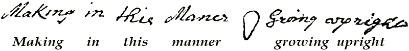
MS. 1050 detail view, showing sketch of oyster.
December 22, 1684 [28]
A Journal of our intended voyage by God's permission from the Island of Gorgonia …
This page marks the beginning of Cowley's new journal. The previous pages were re-written from memory, since the author left his previous journal on the ship Batchelors Delight when he transferred to Eaton's Nicholas.—JW.